


3D Project Management & Site Mapping
What Is 3d Online Project Management?
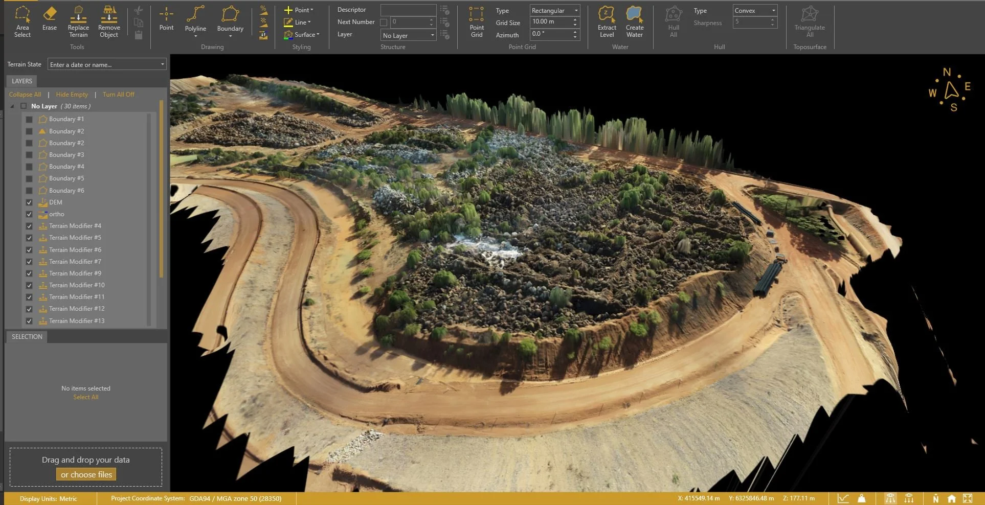
Propeller is a powerful 3D site mapping platform we utilise that turns your survey data into a fully interactive model of your site. It gives your team instant visibility into what’s happening on the ground, without having to be on-site.
Overview of Propeller 3D Software
Eliminate the need for outdated 2D drawings and disorganised spreadsheets. With Propeller, you gain:
► A full 3D model of your site
► Up-to-date visual data and overlays
► A shared view your entire team can access and understand
Benefits for Construction Projects
✔ Faster decision-making
✔ Real-time collaboration across teams
✔ Fewer errors and rework
✔ Easier reporting for stakeholders and clients
Applications in Construction & Engineering
Propeller is more than visual output, it’s a practical, data-driven tool used daily by construction teams to support accurate decision-making and efficient site management.
Progress Tracking & Reporting
See exactly how your site is progressing, week to week.
✔ Track work completed vs. planned
✔ Monitor subcontractors
✔ Keep clients and stakeholders in the loop with visual reports
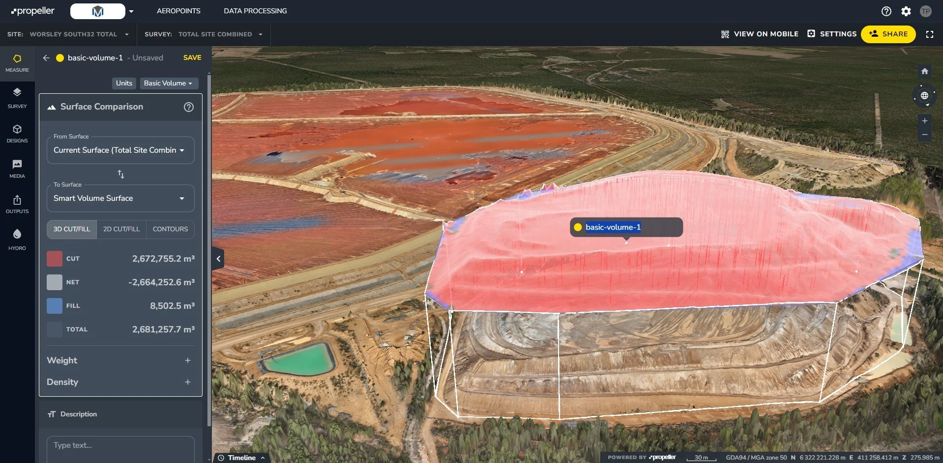
Volume Calculations & Earthworks Management
Need to know how much dirt’s been moved? Propeller does the maths:
✔ Calculate stockpile volumes instantly
✔ Compare terrain changes over time
✔ Improve earthworks planning and reduce machine hours

3D Site ModeLling for Accurate Planning
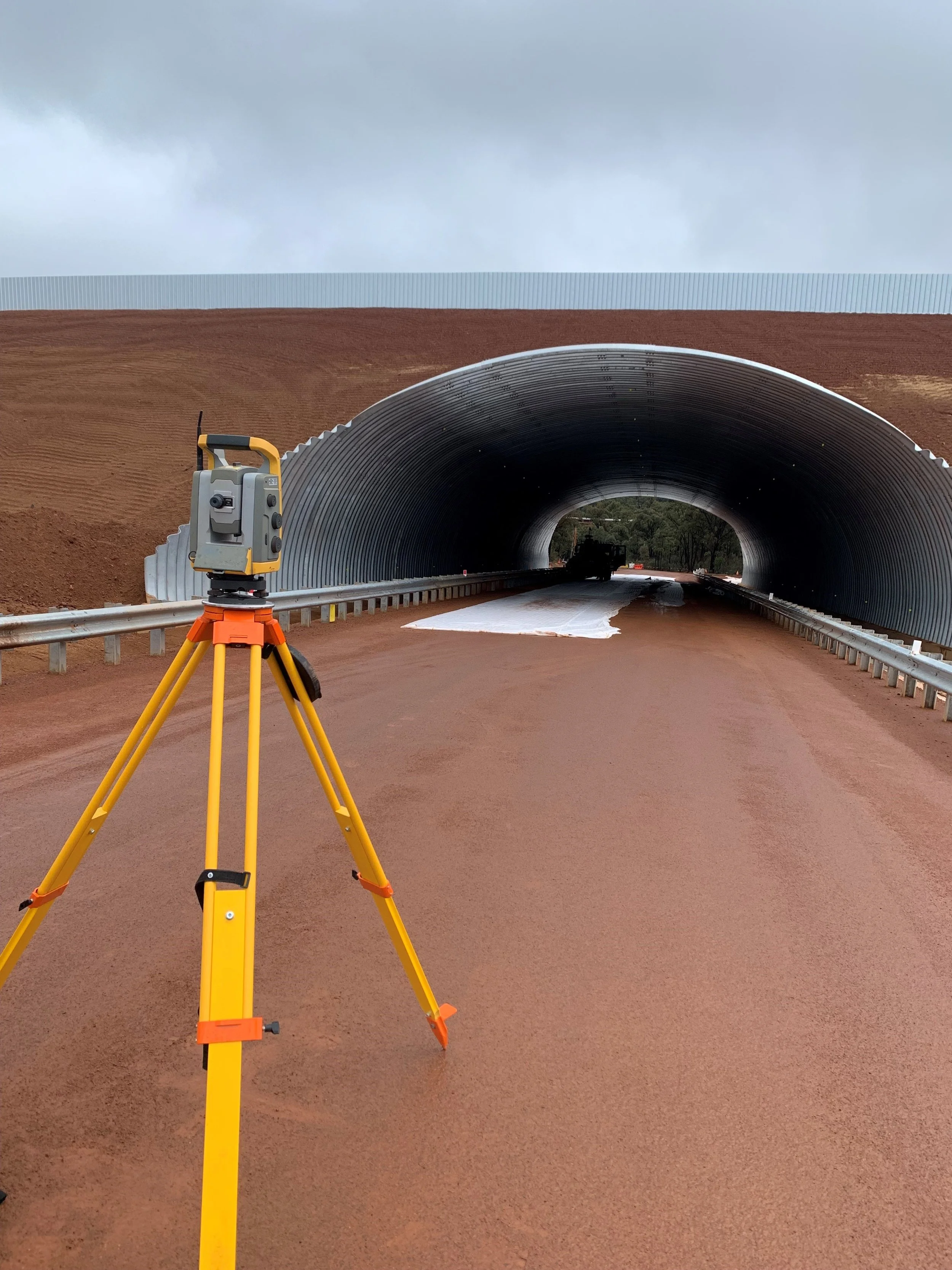
Using high-resolution drone data and GNSS control, we produce centimetre-accurate 3D models that represent current site conditions, not outdated plans from weeks prior.
Centimeter-Level Accuracy with Drone Data
Every Propeller model is:
Built from high-accuracy drone surveys
Tied into real-world coordinates
Routinely updated to reflect the current state of play
Perfect for spotting issues early and adjusting plans before they cost you time or money.
Interactive Models for Real-Time Updates
Propeller models let you:
Zoom, rotate, and explore your site in 3D
Overlay designs, measurements and cut/fill maps
Annotate and share with your team or stakeholders
No software installs required, just log in and get to work.
Seamless Integration with Survey Data
Already using our UAV or GNSS survey data? Propeller integrates seamlessly with existing workflows.
From UAV Surveys to 3D Platforms
We handle the entire data capture process, then upload your survey directly into Propeller, ready for your team to view, measure and manage. This includes UAV drone mapping, RTK/GNSS survey data, and control network integration, all delivered in a streamlined, accessible format.
Cloud-Based Collaboration for Teams
Propeller is a cloud-based platform that enables project managers, surveyors, engineers and clients to access consistent, real-time site data from any location, at any time. It streamlines communication, improves decision-making, and ensures everyone is working from the same accurate information.
Want Propeller on Your Next Project?
Contact us now to learn how Propeller can be integrated into your workflow or ask for a demo using your existing site data.